
An artificial intelligence (AI) firm has adapted its data pipelines and object detection technology for COVID-19.
dRISK is using its expertise in AI to develop a tool the public can use to see how busy public places are at any time. This will help people observe social distancing as we emerge from the pandemic.
The project has been funded by Innovate UK.
Insights from open data
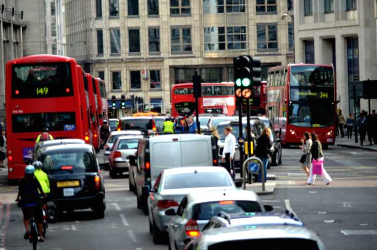
dRISK’s tool uses information from Transport for London’s (TfL’s) JamCams, which monitor the city’s road networks. JamCam data is publicly accessible under TfL’s open data policy.
Sam O’Connor Russell, Project Technical Lead at dRISK, said:
We collect the data, video and imagery from TfL’s JamCams to help autonomous vehicle developers test how safe their cars are.
We realised we could adapt this tool for COVID-19.
Rush hours and normal routines have changed during the pandemic. Our AI tool can be used by the public to check how busy areas are, from Oxford Street and the West End to suburban streets in south London. We’ve collected data since the beginning of COVID-19, providing insight into mobility trends and changes in behaviour across London during the crisis.
Data-driven social distancing
The system uses computer vision models to analyse levels of mobility across London. It is:
- cost-effective
- secure
- does not identify or track members of the public.
It also provides a data-driven assessment of pandemic measures, such as temporary street-widening schemes. It does this by estimating and analysing two metre separation between pedestrians on street.
Business Development Manager Rav Babbra, added:
Giving people the confidence to make journeys and visit the high street will help the UK recover from the economic impacts of the pandemic.
Expanding to other cities
The team has designed the AI tool so that it could neatly slot in with other towns’ and cities’ CCTV systems.
We’re looking at other cities’ data to see if we can expand and offer this service in other parts of the country.
It can help with social distancing in the immediate future, but long-term it could be used for road safety. We’ll be able to capture how people are using crossings, pavements and roads and identify any trouble spots.
Last updated: 12 April 2021