
The Natural Environment Research Council (NERC) has awarded individual grants of up to £1.2 million to seven research projects that will use cutting-edge digital technology to advance environmental outcomes.
As part of the Constructing a Digital Environment programme, these projects will seek to develop tools and systems that will tackle real-life environmental challenges.
The programme aims to construct a digitally enabled environment which benefits:
- researchers
- policy makers
- businesses
- communities
- individuals.
It is funded through the Strategic Priorities Fund.
Led by NERC, the programme is supported by the Engineering and Physical Sciences Research Council and the Department for Environment, Food and Rural Affairs. In total, the grants comprise an investment of more than £6 million.
The successful projects, all lasting 24 months, will deliver:
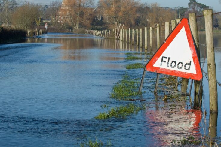
- a flood risk management tool that will help emergency responders to deploy ‘just in time’ maintenance and mobile flood defences
- the development of a monitoring system for the health status of trees and which can act as an early warning system for the movement of current threats and the incursion of new threats
- improvement to existing biodiversity information through producing fine-resolution species distribution models for over 1000 insect species across the UK (focusing on butterflies, moths and grasshoppers)
- a world-class greenhouse gas and ozone depleting substances analysis platform that will provide an open, cloud-based, platform for researchers to share data and analysis methods and publish workflows
- a new point-of-impact flood hazard nowcasting system to meet national coastal management needs, which will have the potential to issue flood alerts to the National Flood Forecasting Service (NFFS)
- research that will combine multi-scale sensor data and models will allow near real-time decision support for farmers and land managers by allowing them to gain site-specific understanding of soil organic carbon (SOC) sequestration and greenhouse gas (GHG) mitigation
- a tool to floods and landslides monitoring tool that will monitor defence stability, an provide advanced warnings of events and improve models and visualisations of data.
Dr Simon Gardner, Head of Digital Environment, Strategic Partnerships Directorate at NERC, said:
The grants announced today demonstrate NERC’s commitment to environmental research. They will support important projects that are building digital tools and systems to combat environmental challenges such as flooding, tree disease and reduced biodiversity.
Further information
Research projects
Platform for dynamic, hyper-resolution, near-real time flood risk assessment integrating repurposed and novel data sources
Lead organisation: Newcastle University
Integration of repurposed and new/emerging data sources into a state-of-the-art hyper-resolution flood modelling system for near-real-time flood risk assessment.
Delivering enhanced biodiversity information with adaptive citizen science and intelligent digital engagements
Lead organisation: UK Centre for Ecology and Hydrology
Undertaking nowcasting of biodiversity information by combining automated high frequency EO data with integrated species data (presence-absence, plus presence-only citizen science data) to create fine resolution, near real-time species distribution models.
Sentinel treescapes for plant biosecurity and risk management – multiple threats
Lead organisation: Food and Environment Research Agency
A sentinel treescape sensor network for monitoring the health status of trees which will act as an early warning system the movement of current threats and incursion of new threats, and as a blueprint for sentinel treescapes UK-wide.
OpenGHG: a community platform for greenhouse gas data science
Lead organisation: University of Bristol
Builds on the previously-funded NERC HUGS project to build a world-class greenhouse gas and ozone-depleting substance analysis platform. This will be integrated with the NERC Centre for Environmental Data Analysis and the UK Emissions Modelling Centre.
Coastal resistance: alerts and monitoring technologies
Lead organisation: National Oceanography Centre
New point-of-impact flood hazard nowcasting system to meet national coastal management needs, which will have the potential to issue flood alerts to the NFFS.
Smart sensing of landscapes undergoing hazardous hydrogeological movement
Lead organisation: University of Exeter
A novel integrated approach to the management of hydrogeological hazards, leveraging advances in wireless sensor networks and internet of things technologies, microelectronics and machine learning.
Dynamic monitoring, reporting and verification for implementing negative emission strategies in managed ecosystems
Lead organisation: James Hutton Institute
Combining multi-scale sensor data with models to allow near real-time decision support for farmers and land managers by allowing them to gain site-specific understanding of SOC sequestration and GHG mitigation.