
We are likely to see overnight frosts, mist and fog, though more impactful cold weather looks less likely.
In the run up to the seasonal holiday one of the perennial questions on people’s lips is, whether it will be a white Christmas.
If so, do I need to change my travel plans?
As well as the myriad considerations like:
- how are we going to smuggle Santa’s gifts into the house
- who is eating with who
- how do we manage the family squabbles or even feuds
On the weather front, thanks to public funding via the Natural Environment Research Council (NERC) and the Met Office, scientists have been improving the accuracy of seasonal weather forecasting for decades.
Now they can predict a white Christmas and other weather events earlier.
What constitutes a white Christmas?
The official definition is a single snowflake has to be observed falling during the 24 hours of 25 December, by either an official Met Office observer or automated weather station.
This is so it is verified and provides consistency and accuracy.
This week the Naked Scientists podcast dedicated an episode to exploring:
- the history and science behind weather forecasting
- the phenomenon of snow
- the technology being used today
- whether we will have a white Christmas
Special guests
As part of the podcast they spoke to Aisling Creevey a meteorologist and ITV weather presenter who also co-hosts a podcast called ‘For the love of weather’.
She talks about the history of weather forecasting, how it has evolved, and where the concept of a white Christmas came from.
Former BBC weather presenter Peter Gibbs who spent two years at the British Antarctic Survey then explained how snow is formed, its varieties and the conditions needed for it to occur.
How is NOC involved?
The team also interviewed Professor Len Shaffrey, Director of Marine Science at the NERC-funded National Oceanography Centre (NOC).
Professor Shaffrey discussed how the research conducted at NOC, partnered with the Met Office, has greatly enhanced the UK’s capability for long-range weather forecasting systems.
Accurate high-resolution ocean models and ocean data are critically important to the UK’s weather and ocean forecasting capabilities.
The results of better forecasting
This leads to economic benefit across a wide range of sectors such as:
- farming
- energy
- transport
- fishing
Professor Shaffrey said:
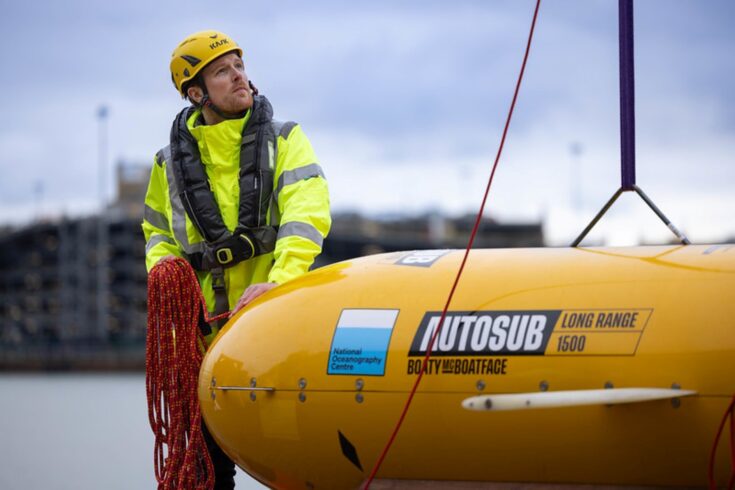
Gathering ocean data using modern equipment such as autonomous marine vehicles has dramatically changed the how we can model weather patterns and make more accurate forecasts.
Why a white Christmas is so rare
Met Office Presenter and Meteorologist Aidan McGivern gave an explanation of the factors affecting a white Christmas, from the position of the jet stream to the battles between polar and mid-Atlantic air.
Mr McGivern, said:
For most of us it’s exciting to see snow in the UK, because it doesn’t happen all that often.
For example, for Christmas Day itself, widespread lying snow (i.e. snow on the ground at 40% or more of the Met Office observing network) has only occurred four times since 1960.
Although, the Met Office definition of a White Christmas is a lot easier to achieve, since it only requires that a single snowflake be reported at any location in the 24-hours of Christmas Day.
He told UK Research and Innovation that a covering of deep, crisp and even snow is uncommon for most of the UK because we are surrounded by relatively warm seas.
These can help to moderate our temperatures compared with other locations at the same latitude.
The science behind snowfall
To get widespread snow in the UK we need the air to be cold enough, and a supply of moisture.
For the cold air, we normally need winds from cold northerly or easterly origins during winter, or a prolonged spell of high pressure over the UK.
This would lead to cloudless skies and temperatures dropping day by day.
For moisture, we need a rain-bearing front to meet the cold air, or for the cold winds to pick up moisture from the North Sea and form snow showers.
There are also the effects of air rising up hills and mountains.
As it’s usually colder higher up in the atmosphere, when air is forced over hills, it often becomes colder, and condenses to form cloud and precipitation.
The precipitation will either be rain or snow, depending on just how cold the air is, and where the ‘freezing level’ is.
Making sure we get it right
Professor Louise Heathwaite CBE FRS, Executive Chair of NERC, said:
Talking about the weather is a part of daily life in the UK and no more so than when we’re nearing Christmas. It’s great to see the public engaging with the science behind weather forecasting.
By improving our ability to forecast how weather systems work we can produce more reliable predictions of whether Christmas will be white, dry or just a disappointing damp.
But changes in the weather are all-year-round phenomena, and extreme weather can wreak havoc in our day-to-day lives or simply make it much more expensive to keep things running as they should.
Our investments in and partnerships with the Met Office and our NERC Centres support the advancement of scientific knowledge, improve the quality of people’s lives, and drive economic growth, by saving money and supporting industries that rely on accurate weather forecasting.
The importance of investment
NERC-funded science has played a big part in better simulation of events responsible for extreme weather in the UK.
For instance, scientists at NOC have improved how sea temperatures and ocean currents are captured in the computer models that power seasonal weather forecasting.
The Met Office is projected to deliver £56 billion of benefits to the UK over the next decade.
The long-standing NERC partnership with the Met Office has played a crucial role in this success.
The wide range of benefits of this work to the UK include:
- more resilient communities and businesses
- avoided costs, disruption, illness, deaths
- less pressure on public services and infrastructure
Through its contribution to the European Copernicus service, NOC has provided the modelling capability for high-resolution ocean forecast and reanalysis information products used by key marine sectors.
This includes for energy planning, government environmental policy and maritime operations.
Benefitting from cutting-edge science
Improvements to the Met Office Unified Model, which is the basis for weather and climate predictions:
Atmosphere-land interactions
The world-leading Joint UK Land Environment Simulator (JULES) model is the core terrestrial component of the Unified Model.
Developed by the UK Centre for Ecology and Hydrology, Met Office and partners, JULES simulates flows of energy, water, carbon and nitrogen between the land, atmosphere and soil.
Atmospheric chemistry
Atmospheric aerosol particles have a substantial effect on climate.
The Global Model of Aerosol Processes developed by the University of Leeds replaced a much simpler earlier aerosol model.
Atlantic Ocean and jet stream conditions
A global ocean model co-developed by the NOC and the Met Office substantially improved predicted sea surface temperatures.
This delivered unprecedented forecast accuracy for the North Atlantic and Arctic Oscillations and enabling prediction of mean winter conditions one to three months ahead.
Sea ice
Amore accurate representation of how the atmosphere interacts with sea ice delivered more realistic predictions for wind, temperature and humidity in the lower atmosphere.
This improved the accuracy of weather and climate forecasts.
It was developed by the University of East Anglia in collaboration with the Met Office.
Urban heat
The Met Office-Reading Urban Surface Exchange Scheme models how buildings exchange heat with the atmosphere.
It has enabled more accurate urban heatwave predictions and is improving the capability of city authorities to plan for future climate change.
It was co-developed by the University of Reading and the Met Office.