
Almost one quarter of the world’s population is directly exposed to significant flood risk. With a lack of durable housing, infrastructure and drainage, floods can be particularly devastating in physically and socially vulnerable areas, such as the favelas of Brazilian cities. However, large data gaps exist on the impacts of extreme weather events on these communities – often leaving them without early warnings.
The ‘Waterproofing Data’ project, which was Economic and Social Research Council (ESRC) funded through the Global Challenges Research Fund, developed an innovative approach combining community-generated data and analytics to increase community resilience and enhance the capacity of residents of flood-prone areas in Brazil to take protective action.
The team’s work has informed the practice of humanitarian organisations and Brazil’s National Disaster Monitoring and Early-Warning Centre, who are now using community-generated data to map risk perception and improve warning systems. The project also empowered the local community to act as ‘citizen scientists’ and take early action to save lives.
About the project
The Waterproofing Data project explored how to build community resilience to flooding by helping residents generate the data used to predict when floods will occur.
Project lead João Porto de Albuquerque is Professor in Urban Analytics at the University of Glasgow and based at the ESRC-funded Urban Big Data Centre. He explains:
There is a lack of information about how heavy rainfall impacts communities at a local level. Our goal was to not only generate and circulate more traditional meteorological data, such as rainfall measurements, but also rethink and broaden the types of data and ways it is gathered.
Engaging with the lived experiences of flooding – people’s memories of what happened and ways they coped – provides an opportunity to tackle the problem in different ways.
The international team of researchers with multiple disciplinary backgrounds from Brazil, Germany and the UK worked with partners at Brazil’s National Center for Monitoring and Early Warning of Natural Disasters (CEMADEN) and Brazilian higher education institution Fundaçao Getulio Vargas to engage communities in the process of ‘data gardening’.
Professor Porto de Albuquerque explains:
Rather than just gathering data, we co-designed methods with the communities that incorporated their priorities about flooding and empowered them as knowledge co-producers.
The team trained 21 local facilitators spread across eight Brazilian cities to teach students and volunteer community members about the concepts of flooding risk, resilience, and how they could generate and analyse data about their own neighbourhoods, such as constructing and using low-cost rainfall gauges.
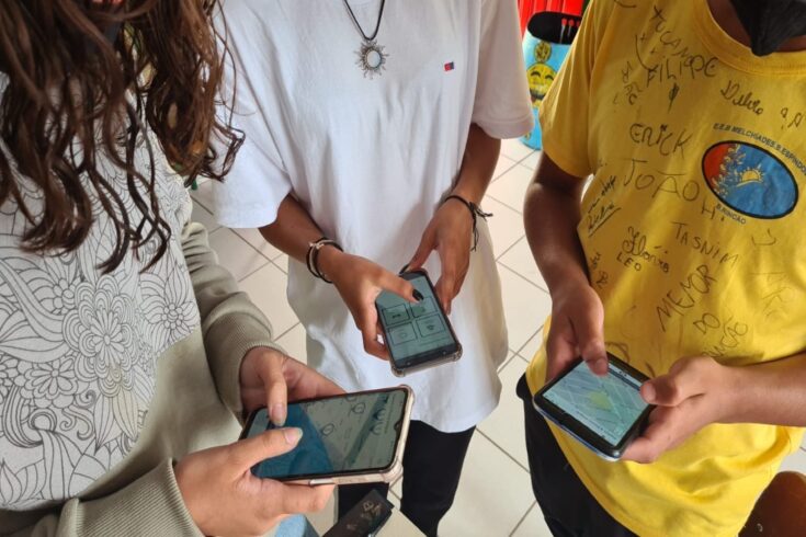
They also worked with local communities to co-develop a Waterproofing Data mobile app and participatory mapping tool where citizens could record daily rainfall, as well as flooding events and their impacts on the neighbourhood.
This community-generated data was shared with flood monitoring agency CEMADEN. This enabled better flood modelling and improved accuracy of flood warnings, as well as greater understanding of flood risk in the community.
Impact of the project
The Waterproofing Data app has now been used by more than 410 ‘citizen scientist’ reporters spread across more than 20 cities in Brazil’s continental territory. It sparked new projects championed by CEMADEN that will bring the Waterproofing Data approach to all school students living in flood-prone areas in Brazil, benefiting more than eight million Brazilian citizens who are estimated to live in disaster-prone areas.
Improving data, increasing resilience, preventing disasters and saving lives
The Waterproofing Data project demonstrated that including communities and citizens in data collection and analytics not only filled existing data gaps but also enhanced the capacity of vulnerable communities to take preventative action and inform risk reduction.
Osvaldo Luiz Leal De Moraes, Director of CEMADEN, says:
The process of co-producing flood related data has enhanced the social inclusion of the elderly people and school pupils involved in the research project and deepened community understanding of flood risks, thereby increasing community resilience.
After severe floods and landslides in June 2022 that took the lives of more than 100 people in the northeast region of Brazil, local civil defence agents reported the positive impact of the Waterproofing Data approach. Two young ‘citizen scientists’ who took part in Waterproofing Data activities in the city of Jaboatão dos Guararapes were able to use the knowledge they gained about flood risks to alert community members in time for them to move to safer places and save their lives.
Democratising data generation and usage
The project departs from traditional flood risk management strategies that rely solely upon costly sensors. Instead, by enabling citizens and communities to contribute data to the national flood early warning system, students and other community members can play a role in preparing and defending against floods.
Professor Porto de Albuquerque says:
While this research was conducted in Brazil, the lessons learned about engaging citizens in data gardening, a method where researchers and citizens collaborate at every stage of the data production and use, showed this approach could be applied to empower community-led climate action in other regions across the world, especially in areas with significant physical or social vulnerability in face of extreme weather events.
Improving flood infrastructure and risk-reduction strategies
The team’s approach to citizen science and co-design of data innovations has expanded the types of data used in disaster risk reduction and engaged more diverse social groups in data generation, circulation, and usage.
Plugging local-level data gaps and establishing better connections to communities has enabled infrastructure improvements and the design of more effective risk-reduction strategies, such as early warning systems to predict floods and save lives.
Find out more
Read more about the Waterproofing Data project.
Watch a short film on Waterproofing Data.
Top image: Credit: João Porto de Albuquerque